Fighting bites with bytes - promoting public health with crowdsourced tick prevention

Description
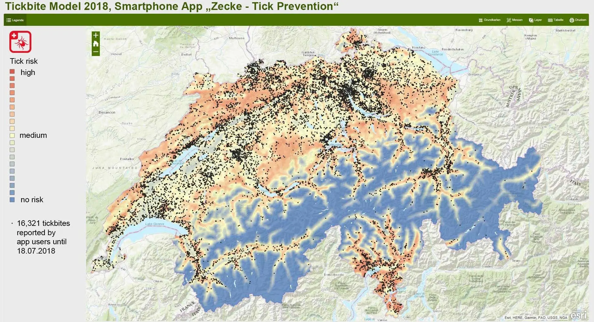
People have good reasons for being afraid of ticks. They are currently on the rise and transmit several infectious diseases, leading to serious illness or even death. In 2018, cases of recorded tick-borne infectious diseases continued to rise, and so did the fear for tick bites. Since March 2015, ZHAW and its spin-off A&K Strategy are operating the smartphone application “Zecke–Tick Prevention”. This app helps people who have been bitten by a tick to remember the tick bite location and to check it for potential Lyme disease symptoms. Half of all tick bites are not noticed and very often, it is not clear at which geographic position and when exactly a tick has bitten someone. The tick incidences reported in the app can serve as a basis for scientists to learn more about spatial tick risks.
ZHAW News "Nur jeder Vierte führt Symptomkontrolle nach Zeckenstich durch"
Working with anonymously transmitted data of unknown quality is the biggest challenge for this study:
● We want to promote public health with a crowdsourced tick prevention tool to visualize the special tick risk dynamically.
● We want to develop a method to handle the notoriously uncertain crowdsourced Citizen Science data.
● We want to create a model to serve people with spatial information about the current tick risk.
Up-to-date visualizations of the tick bite risk are intended to help reducing the risk of tick-borne diseases and, for example, can support teachers in planning locations for forest excursions. An interdisciplinary approach is envisaged that will apply geographical information system scientists (IUNR Geoinformatics group), artificial intelligence and data scientists (IAS Bio-Inspired Modeling & Learning Systems group) and experts in tick biology and prevention (IUNR Phytomedicine and Environmental Genomics and Systems Biology groups).
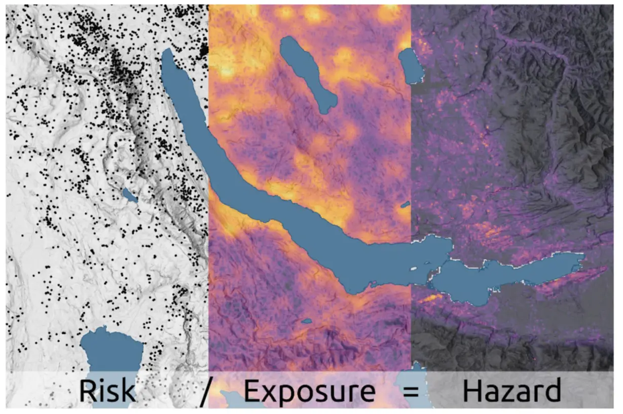
Using around 50'000 reported tick encounters in Switzerland for the period 2015-2020 collected with the Swiss tick app, this project developed and applied spatial data science methods and workflows tailored for a responsible use of rich but biased and uncertain crowdsourced public health data. This included Monte Carlo simulation techniques for accommodating data capture uncertainties of individual tick reports and an exposure model for normalizing uneven spatial distributions of tick reports heavily biased by population density patterns. Additionally, a statical risk model based on a hazard model and the exposure model was generated using machine learning techniques. Hazard is based on environmental parameters influencing ticks. A dynamic model is an extension of the static model with a monthly temporal resolution and using additional input parameters such as month and aggregated weather data. Two validation schemes (i.e., expert panels and a sensitivity and model robustness analysis) showed that the models are giving realistic output and that the exposure model has a large influence on the hazard model. We currently have a first version of a spatio-temporal model for tick hazard, which may be included in the Swiss tick app in due time.
The newly developed model and methods will evoke the interest of the broad public due to its Citizen Science aspect and by addressing an emotionally charged health topic, that has become everyone’s concern.
Links to further information
to map.geo.admin.ch - static Tick bite model 2018
Download smartphone application "Zecke - Tick Prevention"
ZHAW app and information Tick Prevention


