Human Factors Engineering

"A successful system design maintains the user's situational awareness, freedom of action and skills. However, there is no universal recipe for the optimal distribution of tasks between man and machine. Rapid prototyping and realistic tests are therefore indispensable design methods."
The Research Group
The research group deals with the design, analysis and evaluation of human-machine systems. The design follows the philosophy of ‘human-centred design’. When analysing and evaluating, the focus is on the usability of the investigated human-machine interfaces. The research group has the Human-Factors-Engineering Laboratory for the investigation of human-machine systems.
Flight guidance cockpit: Focus is on manual control of complex 4D flight paths. With the adoption of the EU regulation on the creation of a Single European Sky (SES), the legal framework for the introduction of Trajectory-based Operations (TBO) has been established in Europe. A timely introduction of TBO will only be possible if the aircraft crew is enabled to monitor these new complex four-dimensional flight profiles and, if necessary, fly them manually. This requires appropriately adapted flight instruments and procedures.
The Human Factors Engineering group at the ZHAW Centre for Aviation (ZAV) has been working on the design and evaluation of such 4D flight instruments and the associated procedures since 2019.
Flight guidance drones: This research area focuses on the management and manual control of complex 4D drone trajectories. The aim is to develop new concepts and methods for monitoring and controlling the flight path beyond the pilot's line of sight. Pilot's situation awareness shall be improved and his or her workload shall be reduced. E.g. high-resolution LiDAR sensors are used to detect and display obstacles. For the design and evaluation of new display formats the in-house developed mobile Remote Pilot Station (mRPS) is used.
Airtraffic control: A key area within air traffic control is the use of augmented reality in the control tower. When applied correctly, this technology has the potential to enhance air traffic controllers' situational awareness, positively impacting both safety and efficient traffic management at the airport.
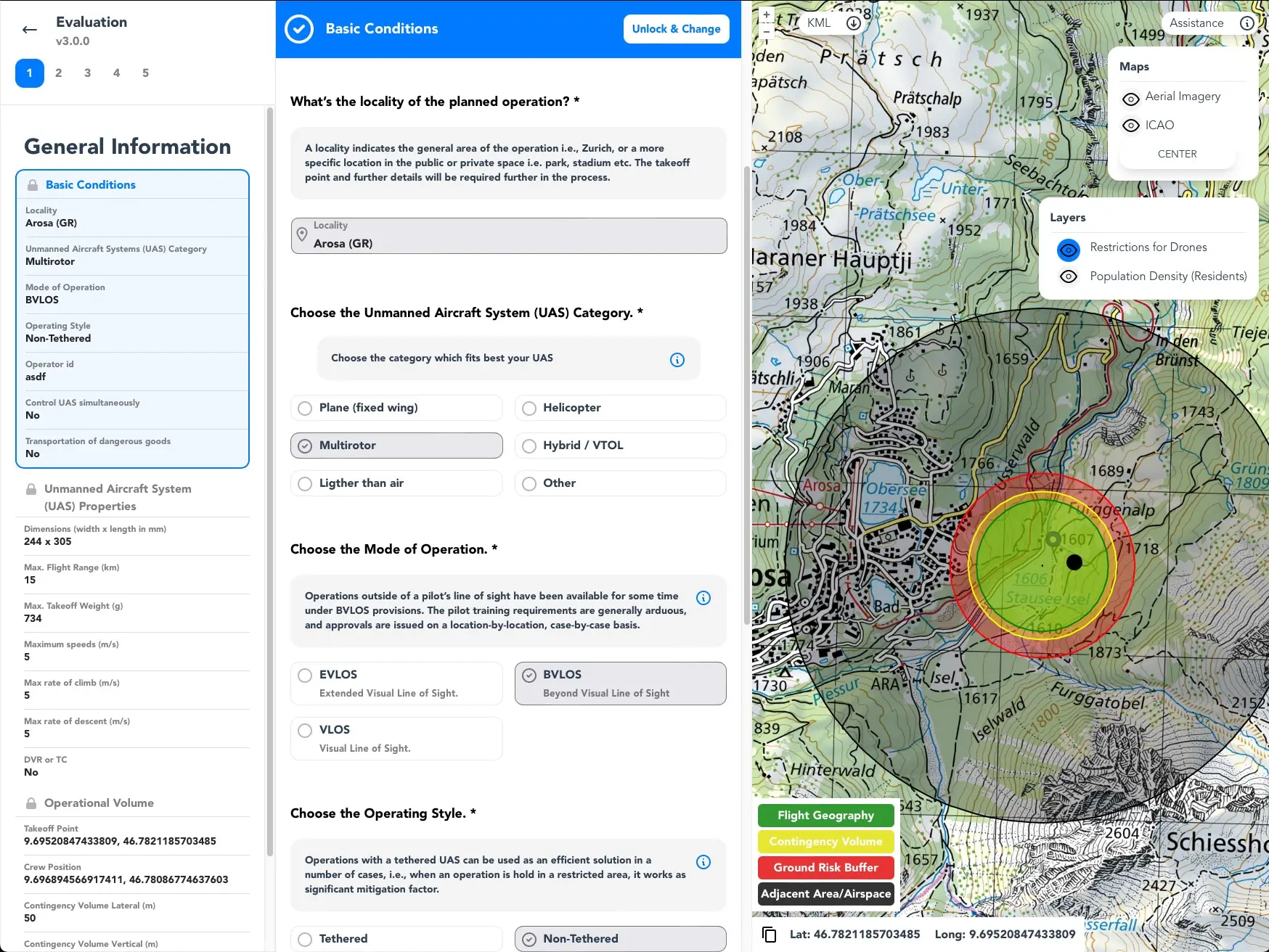
SORA tool: The SORA Tool is a web-based application that guides users through the Specific Operation Risk Assessment (SORA) process for civilian drone operations in a step-by-step manner. It provides an intuitive interface and generates a standardised SORA report that can be submitted to the Swiss Federal Office of Civil Aviation (FOCA) for obtaining operational authorization. The SORA Tool is being actively developed with the aim of becoming the standard SORA application for applicants and authorities in all EASA member states.
Human Factors Engineering Laboratory:
- Cockpit Simulator- Remote Pilot Station (RPS)
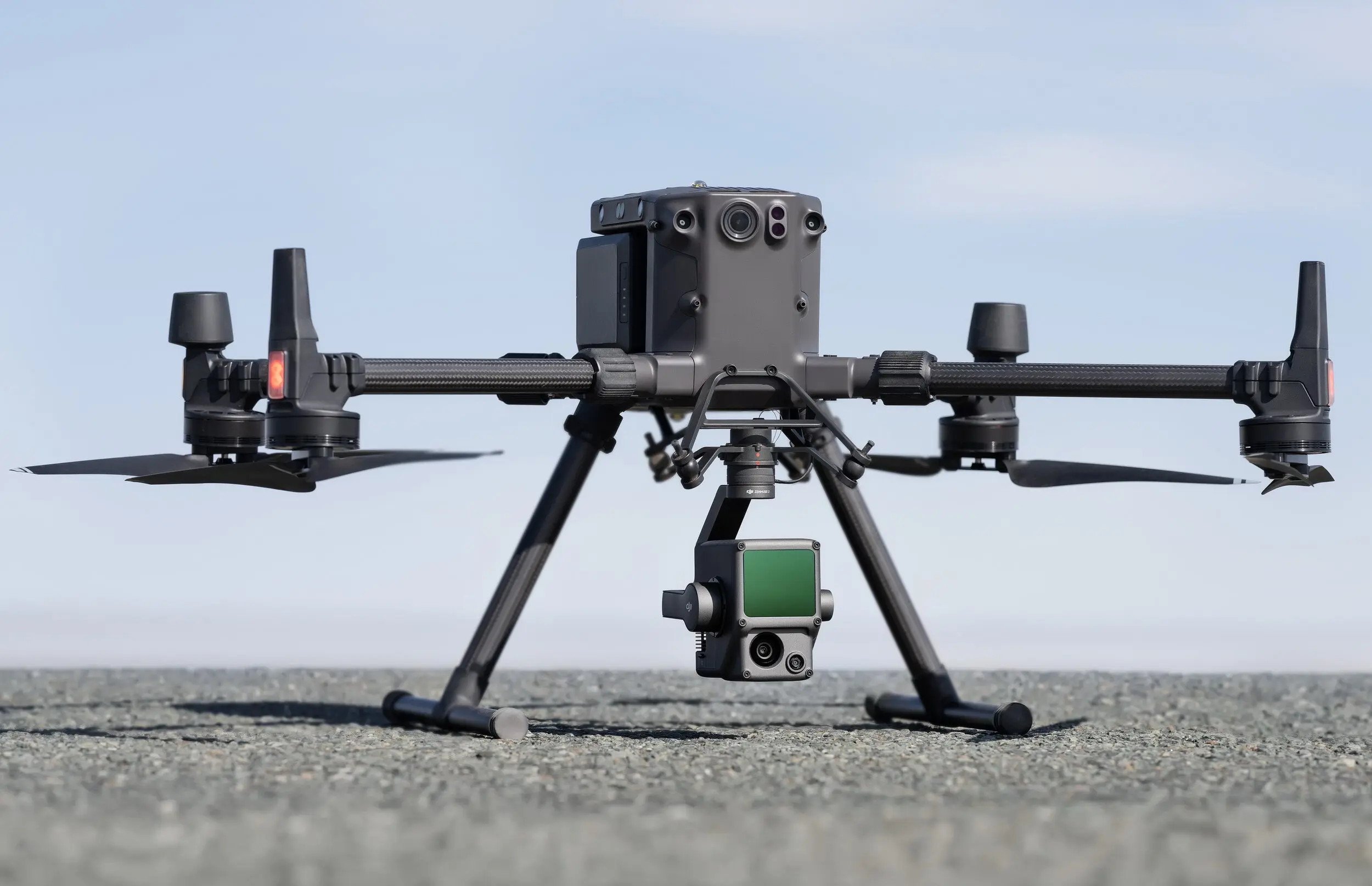
- Mobile Remote Pilot Station (mRPS) Matrice 300 RTK with Zenmuse L2 LiDAR
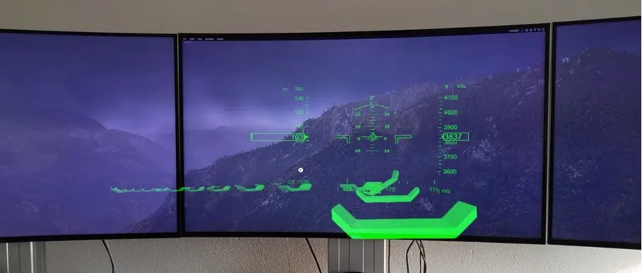
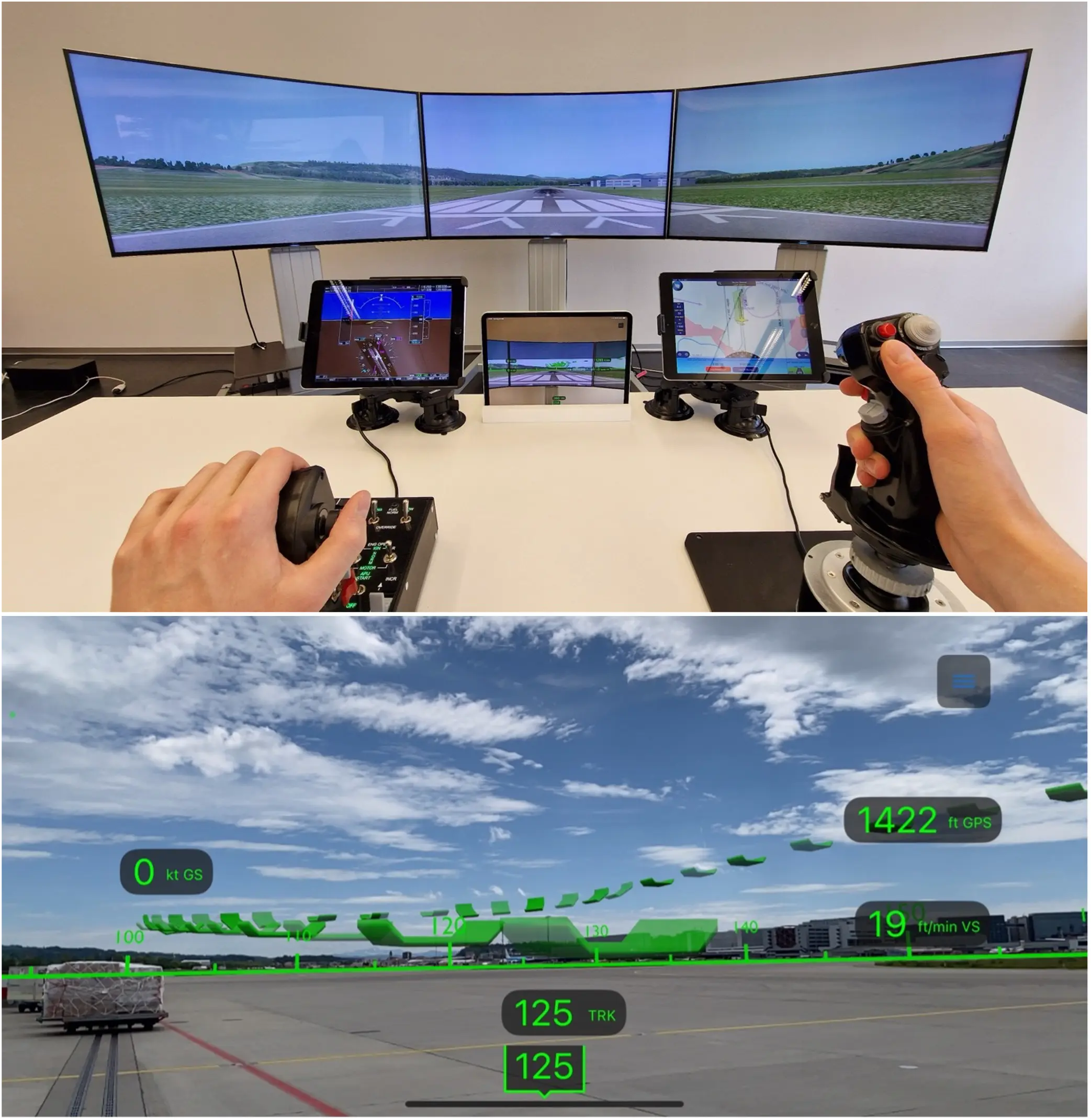
- CockpitLens: The AR application developed for the Microsoft HoloLens 2 projects a head-up display (HUD) into the pilot's field of vision and supports the manual navigation of complex 4D flight paths. The Unity-based application visualises imported routes as holographic waymarks in space and simultaneously displays the essential flight instruments in real time. This gives pilots an intuitive and dynamic overview of critical flight data, which makes situational awareness and decision-making much easier. The application aims to support manual flight navigation and provides an innovative platform for research and future enhancements. Due to the discontinuation of the HoloLens, the application is currently being ported to the Apple Vision Pro in order to benefit from the powerful hardware and extended AR functionalities of this platform.
FlightPad: The FlightPad is an innovative and cost-effective AR application for tablets or smartphones that simulates the functions of a Head Up Display (HUD) and is currently designed for VFR pilots. The application enables users to manually navigate complex 4D flight paths by importing own routes and graphically visualize them in the FlightPad. Additionally, it provides real-time displays of the Basic Six flight instruments, giving pilots a comprehensive overview of all critical flight data.
The user-friendly interface of the FlightPad enhances situational awareness and decision-making during flight, thereby increasing for example the safety and efficiency of flight operations. Future developments anticipate expanding the application with an autopilot and to include IFR pilots, broadening its functionality and user base.
- TowerLens: Live depiction of air- and ground traffic in an AR application on the HoloLens 2.
- BVLOS flight witht M300 and LiDAR mRPS
Impressions